Copy Paste Quotes

Nasa images show wildfire damage to island dubbed ‘Galapagos of California’

The satellite visuals reveal vast burn scars after blaze tore through rare ecosystems on Santa Rosa Island

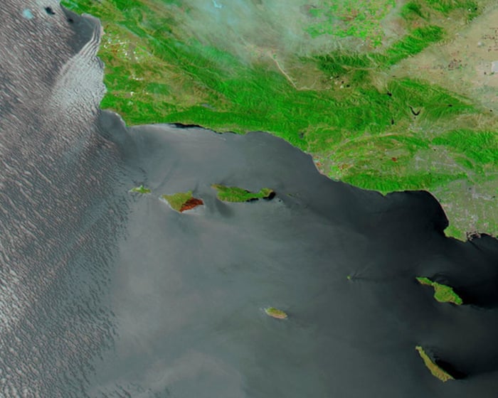
Images from a Nasa satellite showcased the devastating scars left behind by a wildfire that consumed roughly a third of Santa Rosa Island, one of the five islands that make up Channel Islands national park off the southern California coast.

Taken on 20 May, the Moderate Resolution Imaging Spectroradiometer (Modis) took the false-color image of the burn area, showing swaths of blackened land.

Continue reading...

May 27, 2026 US news Nasa Wildfires

Need the full article?

Use the dedicated news page for the summary, then jump straight to the original source when you want the complete story.